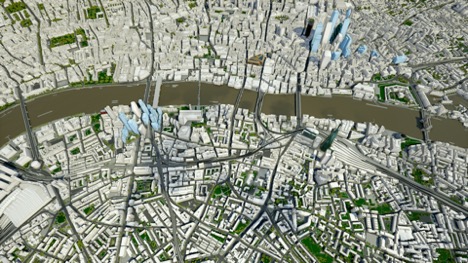
It seems that somehow stringent planning laws in the UK - and especially in London - inadvertently helped the UK to be in the forefront of the digital twins market for cities. UK specific Right of Light, Right of view, Viewing corridors or the Maximum buildings heights grid around St Paul's Cathedral, all of these planning regulations were the reasons behind the creation of competing 3D models of London. This competition means that for developers, architects and urban planners operating in London, the available 3D models are the cornerstone dataset for digital twins and they have been increasing in size but more importantly in accuracy and level of detail.
The downside of this competitive approach is that basic wide area models are fairly expensive and this cost can be prohibitive to SMEs and experimenters from different industries. We try to counteract this by offering a fairly large part of our London model as a free 3D London sample. As the sample is available in a wide variety of formats and Levels of detail, it can be used for most prototyping and proof of concept applications. We also often provide 3D city data to students, hackathon participants and other organisations who approach us with novel ideas requiring different parts of London with our data.
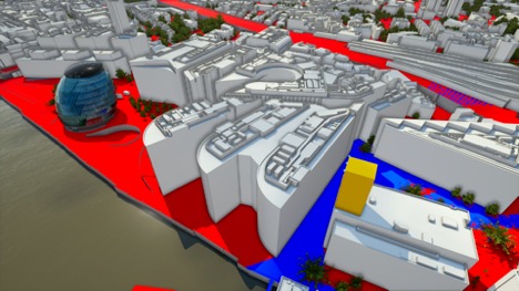
As it has been clear from the various discussions at the National Digital Twin Day 2019, every digital twin needs to be made with a clear aim to solve a problem. Our Digital Twin of London is no exception; it has been developed to fit the needs of the real-estate industry. It allows customers to import and visualise variations of proposed developments in the context of its neighbourhood or even in the context of the entire city. Proposals can be interrogated against local planning regulations such as the London View Management Framework (LVMF). Overshadowing Visual Impact and even daylight and sunlight impact on neighbouring properties can be simulated and proposals can be adjusted very quickly and efficiently.
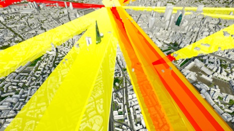
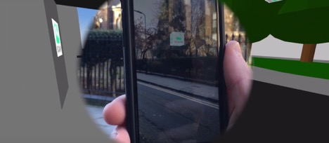
Our company philosophy and a business strategy is to capture once, use many times. With this in mind we are actively looking for other industries that could benefit from access to high quality 3D city maps. AccuCities 3D models have been used for marketing purposes, mostly as a natural extension of their use in planning and architecture. Lately telecoms showed interest in our models as its accuracy helps them to design new high speed wireless networks. Additionally, Augmented reality applications where accuracy and detail of the digital 3D twin of the as-built environment makes all the difference.
Our take home message from the event was threefold. One, the event clearly showed that the UK is at the absolute forefront of this industry. The quality of the delegates was exceptional. Two, as the benefits are so significant, there is an enormous interest in real-world applications of digital twins. Three, we have decided that we need to be much more open with our data. There are challenges but we are determined to work on them and make the state-of-the-art digital models of cities available to as many organisations and developers as possible to speed up this revolution.
Author: Michal Konicek, Director, AccuCities